What the Available Data Shows About the Cottonport Ramp Cut
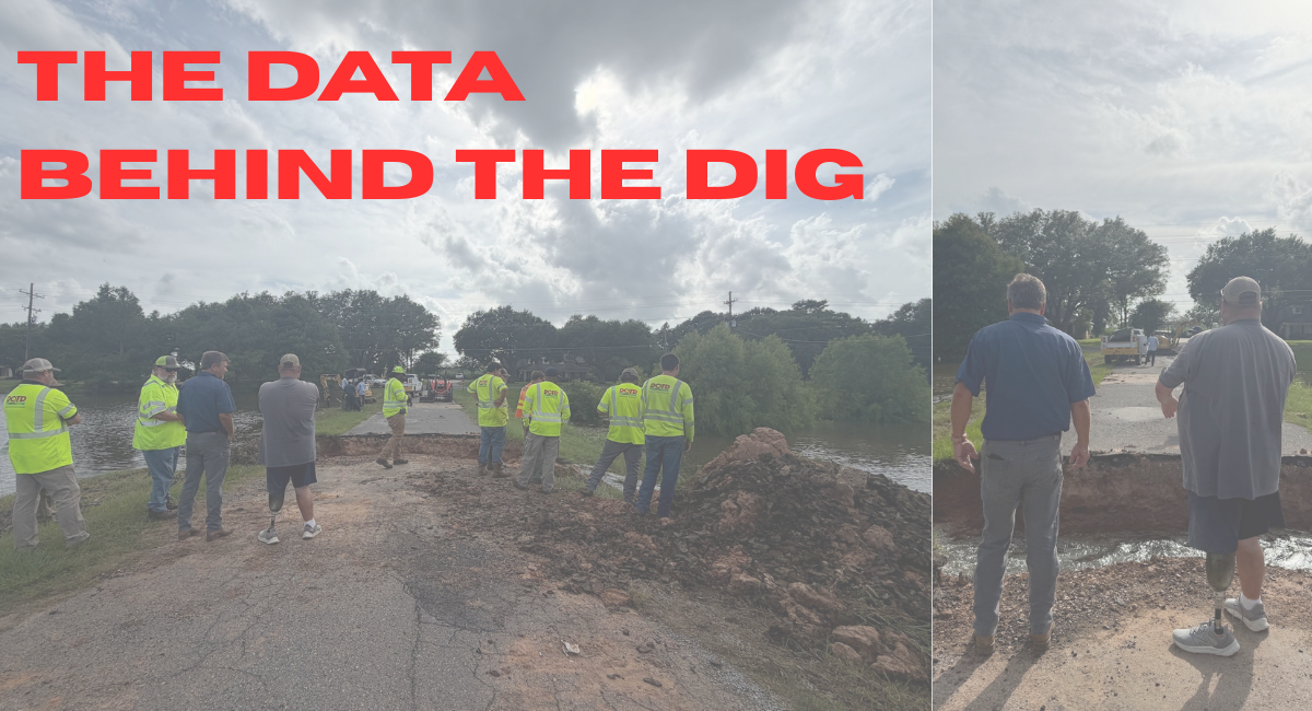
Following the historic flooding of June 18, questions have been raised about an emergency cut made near Cottonport connecting Bayou Rouge and Bayou DuLac.
The purpose of the opening was to improve drainage during an ongoing flood event. Since then, some residents have suggested that the cut may have increased flooding downstream.
To examine that claim, Avoyelles Today reviewed publicly available U.S. Geological Survey (USGS) gauge data, drainage information and the timeline of the event.
According to local officials, the opening was made with heavy equipment at approximately 2 p.m. on June 18.
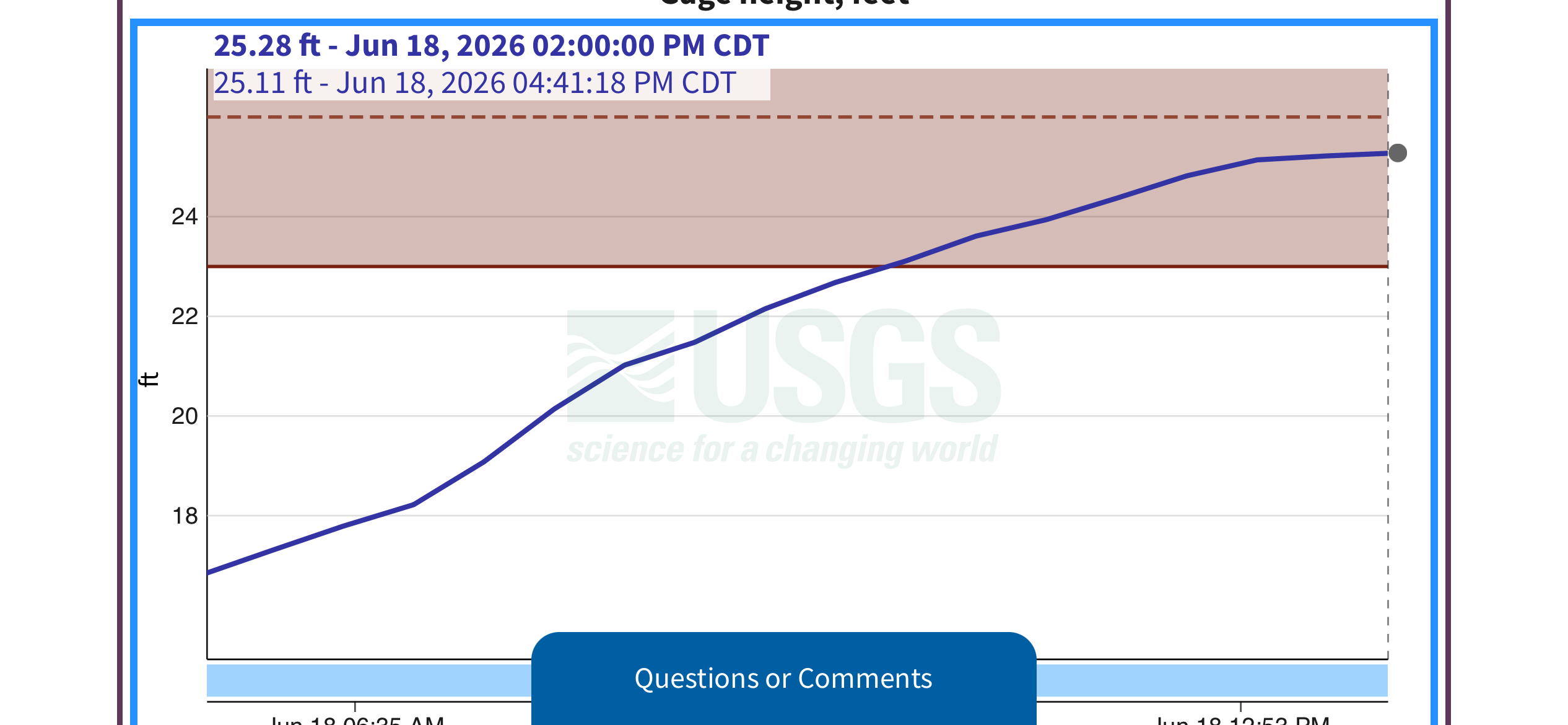
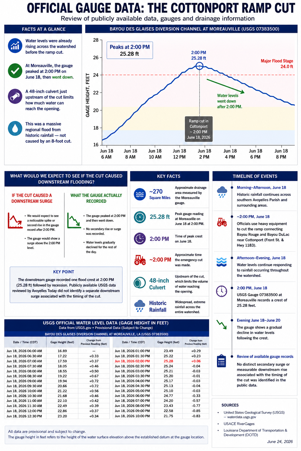
The most relevant downstream monitoring station is the USGS gauge on the Bayou Des Glaises Diversion Channel near Moreauville (Station 07383500). The gauge recorded water levels throughout the flood event and shows that the system continued rising after the cut before reaching a crest of approximately 25.28 feet between 1:30 and 2:00 p.m.
After reaching that crest, water levels began a gradual decline. This means at the time of the ramp work, the water was already going down in the bayou.
The significance of the gauge record is not that water stopped rising immediately after the cut. The watershed was already experiencing widespread flooding from extraordinary rainfall. Rather, the gauge record does not show a distinct secondary rise or surge following the opening.
If the cut had introduced a significant additional volume of water into the downstream system, one would expect to see evidence of that change in the downstream gauge record. The available data instead reflects a single flood crest followed by recession.
The physical layout of the drainage system is also relevant.
Water in this area moves through a connected watershed that includes Bayou Rouge, Bayou DuLac, Bayou Des Glaises and the Bayou Des Glaises Diversion Channel. The downstream gauge measures conditions across a large drainage basin of approximately 270 square miles rather than conditions at a single location.
In simple terms, water entering Bayou Rouge flows into Bayou DuLac, which then flows into Bayou Des Glaises and ultimately into the Bayou Des Glaises Diversion Channel. The flooding observed throughout the area was the result of water moving through this larger watershed during an extreme rainfall event.
It is also important to understand how water behaves during a storm of this magnitude. When large amounts of rain fall in a short period of time, waterways quickly fill and overflow their banks. Once that happens, water does not stay confined to the bayous. It spreads out across flat land, fields and low-lying areas throughout the parish. In events like this, water is moving everywhere at once, not just through one channel.
The gauge data reflects this. Even after rainfall began to ease, water levels remained elevated because water that had already spread across the landscape continued draining back into the system over time. This shows that the flooding was not driven by a single source or pathway, but by widespread inundation across thousands of acres.
Because of this, the water that reached the southern part of the parish did not come from one bayou alone. It came from rainfall overwhelming the entire drainage system at once. In that context, a localized opening, such as an 8-foot cut in one bayou, would have had little to no measurable impact on overall flood levels across such a large area.
In addition, a 48-inch culvert located upstream of the cut restricts the amount of water capable of reaching the opening at any given time. That restriction limits the volume of water that can move through the area regardless of the width of the opening itself.
Based on the publicly available records reviewed, Avoyelles Today found no gauge evidence showing a measurable downstream surge associated with the emergency cut.
The available data indicates that water levels throughout the system were primarily responding to the historic rainfall event affecting the region. While the opening may have altered local drainage patterns near Cottonport, the downstream gauge record does not show evidence of a significant increase in downstream flood levels attributable to the cut.
As additional engineering analyses, surveys or hydrologic studies become available, those findings may provide further insight into the event. Based on the available public data reviewed to date, no measurable downstream surge associated with the June 18 opening has been identified.
Timeline of Events
Morning–Afternoon, June 18: Historic rainfall continues across southern Avoyelles Parish and surrounding areas.
Approximately 2:00 p.m., June 18: Officials use heavy equipment to cut the ramp connecting Bayou Rouge and Bayou DuLac near Cottonport.
Afternoon–Evening, June 18: Water levels continue responding to rainfall occurring throughout the watershed.
1:30-2:00 p.m., June 18: USGS Gauge 07383500 at Moreauville records a crest of approximately 25.28 feet.
Evening June 18–June 20: The gauge shows a gradual decline in water levels following the crest.
Review of available gauge records: No distinct secondary surge or measurable downstream rise associated with the timing of the cut was identified in the public data.
What the Gauge Shows: The downstream gauge reached a single flood crest at approximately 2:00 p.m. on June 18 and then receded. Publicly available USGS data does not show a separate downstream surge following the approximately 2 p.m. emergency opening near Cottonport.


Comments ()